A little-known local point of interest near Bratislava is the Star-Shaped Fort, also known as Csillagvár, from the Hungarian word csillag, meaning “star.” It was given this name because of the shape of its ground plan.
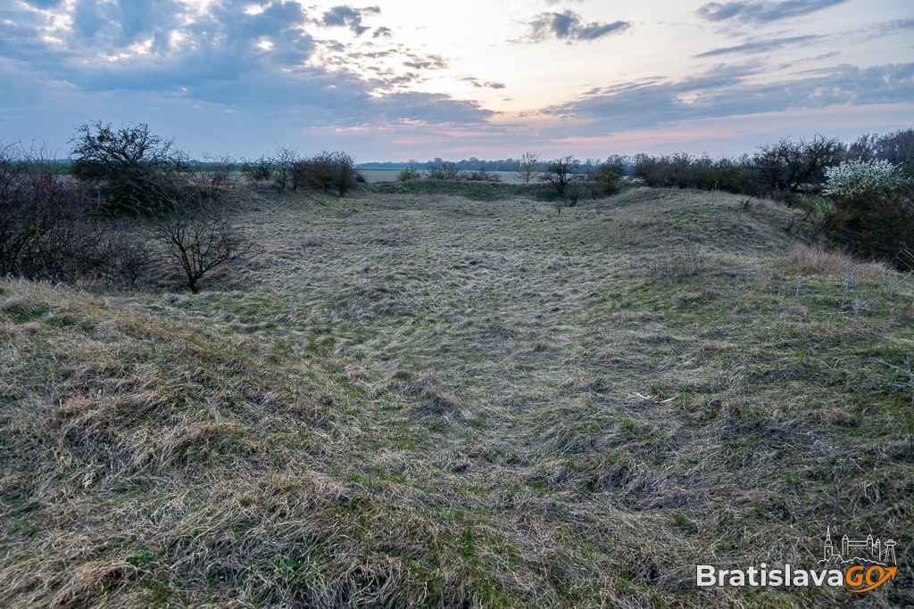
The Star-Shaped Fort is located near Dolné Janíky Vilage – more precisely, what remains of it today are collapsed ramparts and simple structures. Relatively little is known about this 17th-century anti-Ottoman fortress.
We would recommend a visit as a pleasant tip for an easy trip near the capital. It is suitable for families with children as well as older visitors. You can reach it on foot or by bicycle, discovering another beautiful spot by the Little Danube along the way.
The best way to get to Dolné Janíky is by car or public transport. From there, you can set off across local fields on foot or on a short cycling trip. We did not notice any marked trails, but a direct dirt road leads to the ruins of the Star-Shaped Fort in the direction of the Little Danube. There is little chance of getting lost. Children can also manage the route by bicycle, as the terrain is flat.
The fort is located on the right bank of the Little Danube River. The remains of the earthworks still form a clearly recognizable star-shaped layout. In the past, the earthen ramparts served to defend a river crossing. The ferry crossing was also one of the border points of the time.
Today, the immediate surroundings are particularly noteworthy. Sitting right by the Little Danube is very pleasant, and the place has a calm, agreeable atmosphere. You will appreciate this spot if you prefer quieter locations. Of the fort itself, only the outer lines of the fortifications and terrain-covered remains of collapsed walls have survived. More information about the site can be found on the local information board.
The walk from Dolné Janíky to the Star-Shaped Fort is an easy mini-hike that almost anyone can manage. If you come by bicycle, you do not have to worry much about heavy traffic—the dirt road is quite deserted, although an occasional car may appear. The terrain is flat, but after rain the road can become muddy.